
All Rise
As well as being a regular HIP contributor, DAVID EP DENNIS has been appointed as Project Manager for Bexhill-on-Sea Town Council’s Wild Domesday Project. One of his main areas of research is water: sewage discharges, sea level rises due to climate change, saturated ground water table, flooding and tide gates.

The Department for Environment, Food and Rural Affairs (DEFRA) is responsible for coastal and flood defence policy in the United Kingdom. Following recent talks with Environment Agency (EA) personnel, I have analysed the latest sea-rise/flood risk data from EA, the Met Office and NASA. Just like the tides, the situation keeps changing and there are no sacrosanct final figures but instead, estimates – the best possible scenario and the very worst.
Climate Change and Greenhouse Gases
Some say that humans are responsible for the damage being done to our wonderful blue planet and some deny this, pointing to the natural rise and fall in warm and cold periods over the last 800,000 years that brought on successive ice ages and catastrophic flooding.

After the last ice age began to melt some 600,000 years ago, a giant lake built up behind the Weald-Artois Ridge connecting what was to become England and France. There were two major incidents of lake formation. After 150,000 years the pressure became too much for the 100-foot-high chalk ridge and it became a giant waterfall that thundered for thousands of years and finally burst, throwing the remnants of its moraine in the form of shingle and flints into the centre of the ‘English Channel’. These shingle beds have been mapped. Now that sea levels are rising, the first lines of defence are beach groynes and shingle banks. Since scientists believe that the global warming process will continue to at least 2300 no matter what we do, we need to focus on how we tackle the inevitable changes over the next 277 years.
Responsible Authorities
Defending the coast from Eastbourne to Cooden Beach, including Cooden Beach Hotel (inside Bexhill Town Council’s St Marks Ward), is the responsibility of the EA’s Pevensey Bay to Eastbourne Coastal Management Scheme. There are 10,000 homes at risk. The area includes the Waller’s Haven tide gates that allow excess flood water from Pevensey Marshes to reach the sea at Norman’s Bay.
From the Bexhill side of the Cooden Beach hotel, to the edge of Combe Valley in St Leonards-on-Sea, the responsibility lies with Rother District Council, not with Bexhill’s Town Council. Combe Valley itself is a well-known winter flooding area. Like Waller’s Haven it has flood gates at the interface between Filsham and Bo-Peep, the responsibility of the EA team at Worthing. From the east bank of Combe Haven to the cliffs at Rock-a-Nore in Hastings the responsibility is with Hastings Borough Council, helped by the EA. Once we reach Pett Level and Winchelsea Beach we are into the territory of the EA’s Kent and South London Flood Risk Team.

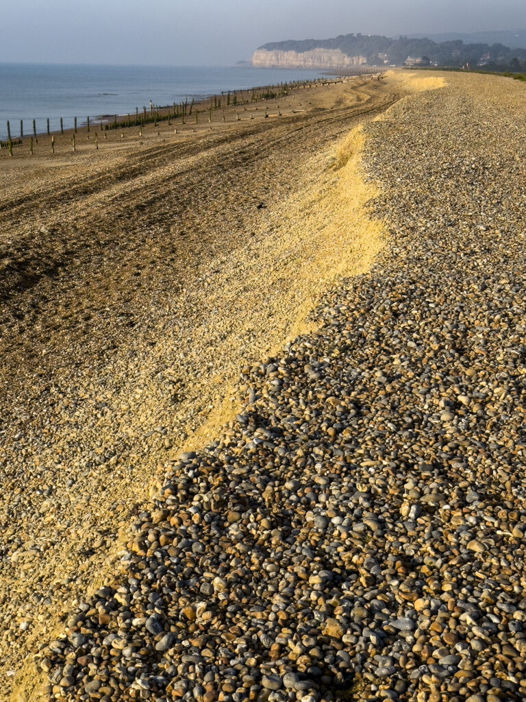
Shingle Defence and its Implications
Despite the eternal longshore drift caused by waves, the shingle cannot get around Beachy Head to Eastbourne and so the ice age shingle banks in mid-channel are being dredged to spread on the beaches of Eastbourne. The EA plan for Eastbourne to Cooden Beach will be researched and refined, with opportunities for public discussion until 2027 when work will begin to ensure that Eastbourne and Pevensey Marshes do not get flooded. The EA states that the main defence is to be shingle banks and groynes. However, it is obvious that if the sea does rise as predicted under mid- to high-scenarios detailed below, or if the almost endless extraction of shingle gets too expensive, then some hard landscaping will be required and shingle spreading may stop. If it does stop, then, since nothing is coming around Beachy Head, the longshore drift will take all the shingle away from the beaches of Bexhill and Hastings unless it is replaced by the mid-channel resources or external area contractors. Worn or damaged groynes allow the sea to take shingle along the coast much faster.
How high will the sea rise?
Scientists measure the rate that the tide heights are increasing. Two government official tide gauges are at Newhaven and Dover, with an additional tide height radar which was fitted to Hastings Pier in 2017. The Hydrodynamics Project Manager of the Channel Coastal Observatory at the University of Southampton’s National Oceanography Centre monitors the Hastings Pier radar.
The National Meteorological Office, known as the Met Office, is the scientific department EA uses to assess how high the tides will become. The Met Office’s Hadley Centre, which studies climate change, draws its data from many global and local sources. It states:
“New sea level projections… show a continued rise beyond 2100 under all climate change scenarios. Sea level rise is the dominant driver of increased coastal flood risk, both historically and in future projections of climate change. Individual UK flood events are usually associated with extreme weather conditions, particularly the generation of storm surges, which can be compounded by the action of wind-generated surface waves. However, projections of changes in frequency and severity of future coastal extreme water levels are dominated by the long-term increase in coastal water levels associated with climate change.”
The Met Office sets out predictions for 2100 to 2300:
“For projections to 2100, the low-likelihood, high impact storyline could lead to an additional metre (3.2 feet) of global mean sea level rise and is associated with loss from both the Greenland and Antarctic ice sheets. The implications for uncertainty in UK sea level projections will need further work because the impact of ice loss from Antarctica is more important for sea level rise around the UK than ice loss from Greenland.”

For projections to 2300, the low-likelihood, high impact scenario could lead to global mean sea level rise of up to about 15m (50 feet). This storyline is based on possible widespread loss from the Antarctic ice sheet. Under this storyline, large ice loss from Antarctica would have an even larger impact on UK sea level rise. This highlights that we need to work with scientists around the world to better understand and monitor the Antarctic ice sheet.”
So how much higher will the sea get on a calm day with no wind or storms? In the nearest area to Hastings under consideration – London – this is the situation:
“Under a low emissions scenario, the approximate Met Office projected ranges at Year 2300 are 0.5 to 2.2m for London. Under a high emissions scenario, this increases to 1.4 up to 4.3m.”
Obviously, these figures will be much worse in winter when storms direct the wind onshore, especially during natural high tides and North Sea surges. Clearly we cannot afford to plan only for calm weather. In order to be safe we have to plan for the worst combination of circumstances and increase our civic resilience.
Hastings Borough Council explains:
“Hastings has approximately 12km of coastline and has powers under the Coast Protection Act 1949 to carry out works to protect the coast from erosion. Major works were carried out from 1987 to 1991 to restore the defences and future works are planned to take account of predictions of sea level rise and climate change. The developed 5km frontage of Hastings and St Leonards is protected by a system of seawalls and groynes which help to retain the shingle beaches. To the east of the town are 7km of sandstone and clay cliffs which extend past the cliff top village of Fairlight to the low-lying land at Pett Level, both of which are in Rother District Council. The cliffs are designated as a Site of Special Scientific Interest and for the 5km within the Borough of Hastings there is a policy of no active intervention, and the cliffs are left to erode naturally.’
What of the future?
At present the strategy is to defend the coastal railway line using giant blocks of granite (see photo). The rest of the coast from Eastbourne to Rye Harbour, apart from any cliffs, will be defended by shingle and groynes. Councils may be short of money or in debt, and replacing groynes and heaping shingle is expensive. If global warming continues at its current rate, then gradually the low tide sands and beaches will disappear, the tide will come in far more quickly and the sea will almost always reach the sea fronts. The coastal towns will not want their sea fronts to be protected by giant granite boulders, so they may have to develop cosmetic solutions involving hard landscaping such as walls and higher sea fronts. There is time to plan, but the cost will be a problem. Other concerns will be public acceptance and planning consents. Inter-tidal wildlife will be affected, and I have already received a complaint from a fisherman about the removal of mid-Channel shingle. Furthermore the coastal path at Bridge Way to Glyne Gap, St Leonards, is already at risk in winter due to waves and cast shingle.
What is today’s state of play?
There is no shingle at Camber, just blowing sand, because Rye Harbour’s storm beach and sea wall stops the shingle moving to Camber. Pett Level and Winchelsea Beach has its shingle heaped up to a six-foot wall, initially making it impossible to get safely onto the beach. On a second visit I found that the sea had quickly softened the profile and reduced the protection. Hastings and Bexhill have shingle and some granite blocks, but many groynes are worn, and some are so low as to be useless.
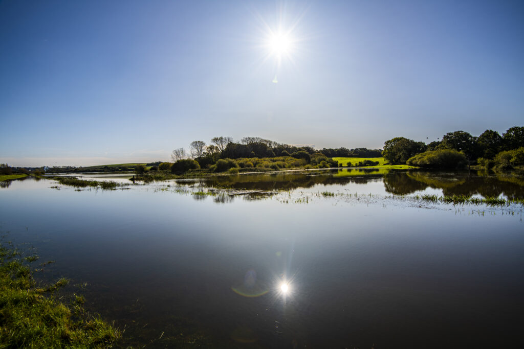
Combe Valley Countryside Park and Crowhurst Village on the Powdermill Stream come under the authority of the EA’s East Sussex Partnerships & Strategic Overview Team, Flood & Coastal Risk Management, Solent & South Downs Area at Guildbourne House in Worthing. Combe Valley suffers from summer drought but is a winter wildlife paradise with a giant lake (see photo).
The Combe Haven tide gates have to be shut at high tide and EA have told me that they do not believe in pumping excess water over the tide gates so hinterland winter flooding will become more severe. However, my personal view is that this is a mistake because Hastings Shopping Centre was once a harbour and so was Combe Valley, and Pevensey and Romney Marshes were once the sea. We may be forced to pump water into the sea at high tide to get rid of flash flooding despite the cost of installation, operation and continued maintenance.
Furthermore, EA warn that the cellars of homes along Bexhill Road at Bulverhythe should not be used to store equipment as they will flood. The EA explains that these homes were built so that the living room and kitchen floors would be above historic flood levels at all times – but not the cellars.
At Norman Bay’s Wallers Haven, the tide gates will have to be shut for longer so the water table on Pevensey Marsh will rise to flood levels. The groynes at Waller’s Haven are so worn away that the shingle is already being stripped off the beaches.
There may also be a temptation as costs rise for agencies and local authorities to vie for shingle and take it off the beaches instead of the centre of the English Channel.
All this would take many years to come to pass if the sea was always calm and there were no storms. However, because the climate is now more chaotic than usual, anti-flooding measures are even more vital. In the mid to long term, people will have to adapt to a different Eastbourne, Bexhill and Hastings with significant sea defences, making beach holidays difficult, and the stripping out of coastal paths, cycleways and sea edge housing due to erosion.
Humans have adapted to climate change for thousands of years and modern detection systems are superb. Yet there is no doubt that on current data, our children and their children will have a very different time when they go to the seaside. Even if we don’t have sufficient political will or motivation and even if people do, or do not, believe in climate change, change is coming. We need to be ready for it.
We hope you have enjoyed reading this article. The future of our volunteer led, non-profit publication would be far more secure with the aid of a small donation. You can also support local journalism by becoming a friend of HIP. It only takes a minute and we would be very grateful.

That’s a really interesting article, thankyou. Good to see that decisions are being made with climate change in mind although the caveat is always ‘if we can afford’ the mitigation, and looking at the current council’s financial situation sadly the answer is ‘not really’.
I firmly believe that nature based solutions are vital at this point, further defences will inevitably become insufficient, whereas flood plains and so on dissipate wave energy and create habitats.
Would the author be open to further discussion? It’s a subject that is very close to my heart too.