
Up Banking
With millions of coastal homes at risk from flooding, DAVID EP DENNIS outlines the vital work
of the Environment Agency in keeping us all from being inundated by rising sea-levels
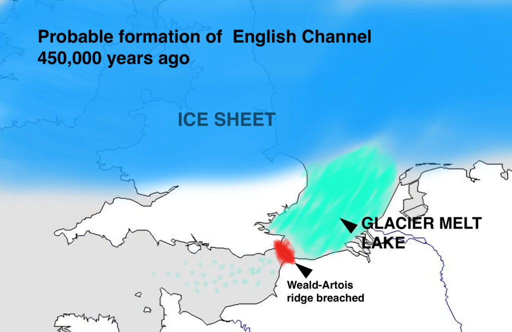
The south coast of what was to become England was formed after the last Ice age. The great rivers now known as the Thames, Seine and Rhine all flowed into an embayment – a large bay – to the north-east of Kent. England was still joined to Europe via Doggerland and a 21-mile-long chalk ‘land bridge’ – the Weald-Artois Ridge – about a hundred feet high that connected Dover’s white cliffs to those of Cap Gris-Nez south of Calais.
As the glaciers covering the North Sea began to melt around 600,000 years ago, a huge lake built up behind the ridge. After 150,000 years the pressure became too much for the chalk and it started to breach, perhaps beginning with a giant waterfall that thundered down into what is now the Channel. The dam finally burst, creating a megaflood that threw the remnants of the glacial moraine in the form of millions of tons of stones and flints into the centre of the channel. This was to become the shingle that we know so well from our local beaches today.
Another source of shingle is from cliff collapses and erosion both in sandstone and chalk areas. The calcium chalk of Beachy Head slowly releases hard flint nodules, and the sedimentary sandstone areas give smaller brown pebbles, usually angular. Millions of tons of shingle sit in the centre of the English Channel and this is dredged and moved onto our seashores and beaches to safeguard low-lying land behind them – as in the Dymchurch sea wall that has protected the Romney marsh since Roman times.
Shifting shingle
The problem is the shingle doesn’t stay where it’s put. It is moved down the coast naturally by the prevailing currents and winds in a process known as longshore drift. This usually moves from Eastbourne towards Rye though just occasionally the wind from the east is strong enough to turn the waves in the opposite direction. But unless the shingle is moved back down the coast, it builds up barriers at the eastern end and denudes the sea defences to the west.

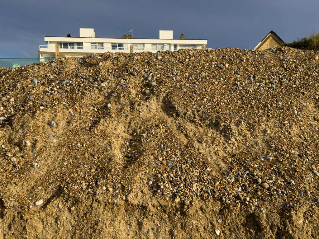
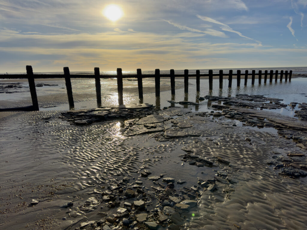
The artificial movement of shingle back along the shore is enabled or contracted by the Environment Agency. They stack up the stones at various points – for example the huge mound seen at Cooden Beach Hotel – then this is distributed by tractor vehicles between the wooden groynes. If not repaired, when groynes are worn or damaged by storms, the shingle moves faster along the coast. So, on top of the cost of dredging shingle from mid-Channel to place on our beaches there is also the cost of repairing the groynes. Most are made of wood, but some are stone. The sea is so powerful that either can be damaged.
Back in medieval times, there was a constant battle to save farmland. Many areas were repeatedly flooded, so a system called ‘bisket and trisket’ was developed to ensure that Pevensey Marshes’ recovered farmland was saved from the sea. This meant that every farmer had to ensure their land had a wall against the sea’s incursions and if that wall was not properly maintained then neighbouring farmers would do the work and charge the cost to the ‘lazy’ or ‘ill’ farmer who had somehow failed in his duty. However, there were some storms that no man could counter. The two Grote Mandrenkes (Great Drownings of Men) of 16 January 1219 (36,000 dead) and 1362 (25,000 dead) were both on the Feast of St Marcellus.
Now in 2024 we rely completely on the Environment Agency (EVA) to help the local councils and the coastal road and railway authorities. Responsibility for the coast from Rye Harbour to Eastbourne is shared by Thames & Foreland EVA Division, the Eastbourne Division of EVA, and Rother District and Hastings Borough councils.
EVA strategies
The Flood and Water Management Act 2010 places a statutory duty on the Environment Agency to develop a National Flood and Coastal Erosion Risk Management Strategy for England. This strategy describes what needs to be done by all risk management authorities (RMAs) involved in flood and coastal erosion risk management for the benefit of people and places. This includes the Environment Agency, lead local flood authorities, district councils, internal drainage boards, highways authorities and water and sewerage companies.
A new policy has been developed called the 2020 Flood and Coastal Erosion Risk Management Strategy. This strategy’s long-term vision is for: a nation ready for, and resilient to, flooding and coastal change – today, tomorrow and to the year 2100.
The future
The Environment Agency reported in 2019 ‘that over 5.2 million homes and properties in England are at risk from flooding and coastal erosion. In the Eastbourne to Cooden sector the number of homes at risk is ten thousand. Yet only a third of people who live in areas at risk of flooding believe their property is at risk. Many more people are affected when transport services, energy or water infrastructure are damaged or disrupted. For every household directly affected during a large flood, about 16 people suffer knock-on effects from losses of utility services.’
One sign to look for is the erosion of the concrete platform under the Mary Stanford Memorial Lifeboat House, where the sea is wearing away the land daily. There are many cliff falls along the coast and the Eastbourne Martello Tower base is being undermined as can be seen in the photo. Another area of concern is the foot and cycle path between Bridge Way, St Leonards and Glyne Gap where the sea regularly throws shingle onto the railway tracks and walkers and trains are hit by huge clouds of sea spray. So, we need to understand that global warming and climate change does have implications, not just for far-off countries with low-lying land but for us here in the UK where once the sea lapped the edges of early Cambridge, and Northeye, Rye and Old Winchelsea were islands in a vast and troubled sea.

Pumping water
Shingle and groynes are the only defence so far proposed. If Eastbourne authorities decide to use concrete as a solution then, because no shingle will come round Beachy Head, the beaches along to Hastings will be stripped by the longshore drift. We also have taken away all our natural floodplains into pipes that enter the sea and so Hastings has had to have pumps installed to save the Priory Meadow Shopping Centre which was built over the top of a river.
Inevitably we will have to use pumps more and more as the ground becomes supersaturated. This has already happened at Cooden Moat and Cooden Ancient Wood fields, which are ‘squelchy’ under foot because of the almost permanent raised water table. Let us hope that any future government gives the Environment Agency the funds it needs to keep us all safe from rising tides on our beautiful sea coast.
We hope you have enjoyed reading this article. The future of our volunteer led, non-profit publication would be far more secure with the aid of a small donation. You can also support local journalism by becoming a friend of HIP. It only takes a minute and we would be very grateful.

Leave a Reply